Back to GFC Weather Home Page
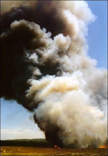
A PROGRAM TO PREDICT SMOKE CONCENTRATIONS FROM PRESCRIBED FIRE IN GEORGIA
(A program to assist prescribed burners with smoke management planning?)
|
 You will be asked to:
Click a point on a state map to locate your fire
Enter fire information
- Select the fuel option - Fuel Locations and Emission
-
- From Photo Series
-
- From Stand Characteristics
-
- Enter fuel loading and emission directly
- Select the weather option
- Weather to be automatically supplied by Georgia Forestry Commission Weather System
- Weather data to be entered manually.
Although VSMOKE is specifically for daytime conditions, it will return an interpreted value for the Low Visibility Risk Occurrence Index.
The program will then return a series of topographic maps with an overlay of smoke concentrations. Some smoke sensitive areas such as hospitals,
nursing homes and airports will also be shown.
This tool is provided to encourage environmentally friendly and safe prescribed burning. It should be used in conjunction with "common sense"
judgment when accessing the impact of smoke from your fire.
|
Scott Goodrick of USFS Athens developed another version of
V-smoke (Alternate Link)
that used Google Maps as the map background.
Webinar by Scott Goodrick from Feb 20, 2014
|
Charles Bailey of GFC developed a smoke plotter that can be overlaid on Google Earth with this legend.
Once they are loaded into Google Earth, you can "right-click" on "SmokePlotterHollow", and then click "Properties". Then, you can move the smoke plotter around
by clicking on the Center Cross. You can turn the plotter by clicking on the Diamond near the center of the "V". The contours lines are
0.5, 1.0, 1.25, 2.0, 2.5, 3.0, 5.0, 7.5, 10, 20 and 30 miles from the origin.
|
Beginning in Oct 2011, NWS can run HySplit. Click here for details.
Spot Weather Forecast link from Peachtree City, GA is here
This NWS page has links for "Fire Weather", "7-day forecast", "Hourly Forecast Graph", "Digital/Tablular Table" and a link to "Request Spot Forecast".
|
Displaying all Airports, Hospitals and Nursing Homes (a kml file) in our Web-based V-smoke System
GFC collected these data around 2005. The data has not been thoroughly checked for accuracy.
They are just for reference only. Prescribed Burners are still responsible for checking Smoke Sensitive Areas near their burns.
|
|
|